


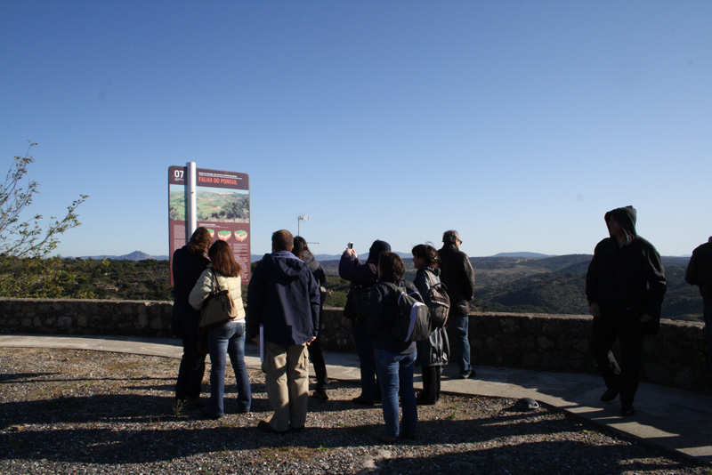
Viewpoint of São Gens Castelo Branco
Located next to the castle, which can be accessed through a long staircase that connects the viewpoint to the Wall. The Viewpoint of São Gens was target of a recent requalification through the program POLIS. In it ca be obtained an impressing view of the northeast point of the city of Castelo Branco, overlooking, among other areas, the Episcopal Palace Garden or the City Park, having a virtual viewpoint.
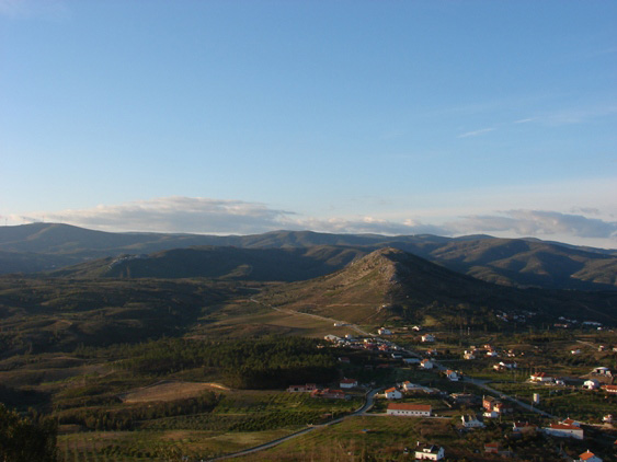
Geomorphological Viewpoint of Corgas Proença-a-Nova

Located in the region of Proença-a-Nova, next to the limits of the Oleiros municipality, this viewpoint extends itself in the plain back of the schistose mountains, sweetened by the geological times. Between heathers and brooms, the gaze fades in the vastness of time until the curious form of the Talhadas Mountain, which embodies the U shaped super-fold - o the Syncline of Ródão. Piaget Replica Watches
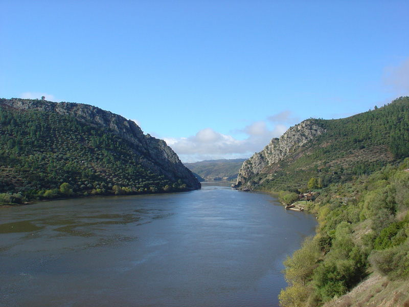
Viewpoint of Sobral Fernando on the Portas de Almourão Proença-a-Nova
This viewpoint, a geosite of Naturtejo Geopark, allows a privileged observation of the grading of the fluvial terraces downstream of Portas de Almourão, between the Sobral Fernando and Foz do Cobrão river banks, between the quotes of 160-130m, and the “Conheira” of Foz do Cobrão-Sobral Fernando, allowing a wide panoramic view of the area where were developed the Roman mining works and where nowadays the traces of this exploration are placed. From this point is possible to watch the Valley of Ocreza, deeply carved in the Talhadas Mountain, with a drop of more than 350 m.
Geomorphological Viewpoint of Galego Proença-a-Nova
The Geomorphological Viewpoint of Galego, located in 618 m high, is an observation point for fires prevention that allows a panoramic view of 360º, giving a geomorphological perspective of the region in a range that easily surpasses the 100 km. It stands out as an example the Moradal Mountain, the Talhadas Mountain and the Valley of Ocreza, the Central Mountain range embodied by the Alvelos-Espadana Mountain and the dense drain network of the Castelo Branco surface.
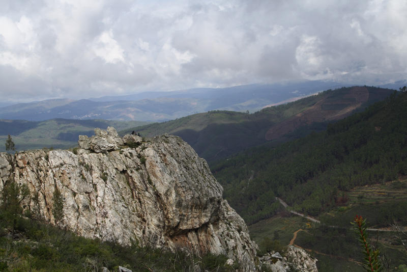
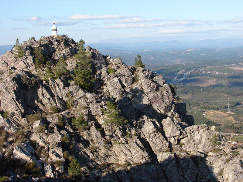
Viewpoint of Cabeço Mosqueiro Oleiros
This geosite makes up an excellent geomorphological viewpoint at the top of the Penedo das Sardas, in 666 metres high, and 300 m above the Zêzere Gorge, with an wide perspective of the relevant elements: from the Central Mountain Range: granites of the Gardunha Mountain and the Estrela Mountain, with a privileged view of the magnificent Glacier Valley of Alforfa; quartzite alignments of the Moradal Mountain and the Boulders of Góis, to NW; the spectacular meanders of the Zêzere river; schistose hills of Açor (N), Lousã (NW) and Cabeço Rainha (SW). This viewpoint points out not only the rocky outcrops, but also the shrub vegetation made essentially by helophytic bushes, from which stand out the rockrose (Cistus ladanifer), the prickled broom (Chamaespartum tridentatum) and the gorse (Ulex sp).
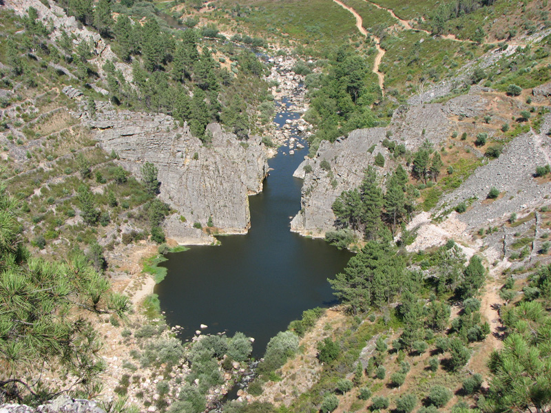
Viewpoint of Zebro Oleiros
From this quartzite cliff the vertiginous panoramic views stretch themselves through the valley of the Casas da Zebreira Stream, which runs 200m under.
Geomorphological Viewpoint of the Monsanto Castle Idanha-a-Nova
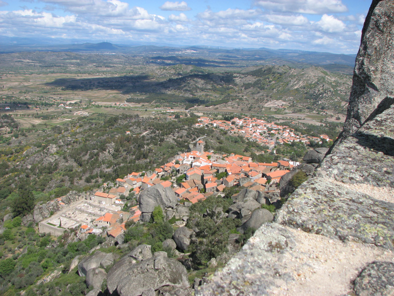
Installed in the ancient “Castro” settlement, the actual castle of Monsanto was one of the most emblematic sentinels of the “Raia” region. From the geodesic vertex or from its walls, the impressive 360º landscape embraces far more beyond the plain territories of Idanha. From the geodesic vertex (758 m) to SE can be seen the surface of the North Alentejo, Surface of Castelo Branco, Murracha, Murrachinha and Pedras Ninhas Mountains sealing the Ponsul fault; to E the Syncline of Penha Garcia; to N the Inselbergs Moreirinha and Alegrios; to S the S. Mamede Mountain; to NE the highest point of Portugal – the Estrela Mountain; to SW (far away) the Portas do Ródão and the ending of the Syncline of Ródão in the S. Miguel Mountain.
Viewpoint of the ruins of the S. João Chapel Idanha-a-Nova

In the viewpoint of the ruins of the S. João Chapel, in Monsanto, through the arch, it’s possible to observe the residual embossments of the Murracha, Murrachinha and Pedras Ninhas Mountains sealing the Ponsul fault. Is also visible the Surface of Castelo Branco (raised block) separated from the Surface of North Alentejo.
Viewpoint of the Penha Garcia Castle Idanha-a-Nova
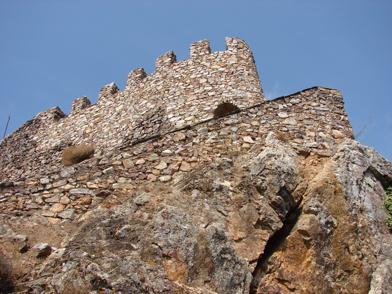
The ruins of the medieval castle, apart from its historical-archaeological interest, are a beautiful geomorphological viewpoint overlooking the quartzite crest of the Syncline of Penha Garcia, the schistose core, The Plain Surface of Castelo Branco, the Inselbergs of Monsanto-Moreirinha, in the background the Central Mountain Range (Estrela Mountain) and the residual embossments of hardness of the Murracha, Murrachinha and Pedras Ninhas Mountains, on the Ponsul fault line.
Viewpoint of Salto da Cabra Idanha-a-Nova

The Viewpoint of Salto da Cabra allows observing the Fluvial Gorge of the Erges River, which runs here, deeply settled (100 m) and where the water finds rocky obstacles that goes surpassing and eroding. The effect of the water shapes the rocks, making them sweetened and polished. From here can be seen the most impressive landscape on the epigenic gorge of the Erges River. On the top of the Spanish River bank, can be seen the ruins of the magnificent Castillo de Peñafiel, in a regional well matched granite. These cliffs find themselves carved by a strong fracture, which gives to the landscape a “ruined” appearance known as “Canchais” in the popular terminology. It’s an area with rich natural heritage, with an exceptional biodiversity marked by the vultures fly and the exceptionally rare black storks that nest here.
Viewpoint of the Idanha-a-Nova Castle Idanha-a-Nova
Nowadays, from the Medieval Castle built in the XIIth century, only remain some ruins, but its location is easily explained by geological reasons. The keep was erected in the raised block of the Ponsul fault, one of the most important active faults in the area. This gigantic step that splits the Surface of Castelo Branco da Superfície from the North Alentejo was a structure of natural defence, having been the most obvious reason for the construction of the castle, as well as other defensive structures, along the same line. This viewpoint yet allows to observe not only the enormous step of this fault, but also the geomorphology of an extended area of the Naturtejo Geopark, standing out the flattening surfaces (North Alentejo), residual embossments (Inselberg of Monsanto, quartzite crests of Penha Garcia, Monforte da Beira and its extension to S. Martinho-Castelo Branco, Sierra de S. Pedro and S. Mamede Mountain), etc.
Viewpoint of the Moorish Castle Vila Velha de Ródão
This Viewpoint is placed in the proximities of the medieval watchtower known as the Castle of King Wamba, reason for countless legends and myths and of the Chapel of Nossa Senhora do Castelo. This is an internationally known birdwatching point, not only by the abundance of birds but also by the high landscape interest of this region, highlighted by its geology and geomorphology. From here is possible to make a landscape reading: in foreground can be seen the quartzite walls that form the super-structure Syncline of Ródão that were crossed in this point by the Tagus river, it’s also possible to observe some of the fluvial terraces of the Tagus, disposed layer by layer, and to observe the great erosive-tectonic laceration of the Portas do Ródão. Downstream, there’s a fantastic panoramic view of the tectonic compartment of Vila Ruivas – Arneiro, parallel to the quartzite crests and constrained by the Arneiro-Ponsul fault and by the South crest of the Syncline of Ródão. In the margin of Nisa can be seen the pilled stones in the “conheiras” as a result of the terrace dismantling that corresponds to Vilas Ruivas for gold exploration, during the Roman period. The alignment of the mounds is perfectly distinguishable, in the banks of channels that had served to transport the water for the washing of sands rich in gold and drained afterwards to the Tagus River. Closer, can be observed the Island of the Virtues Fountains, in mid Tagus, where was an intense exploration of inert which, together with the raise of the water levels created an artificial “Island” connected to the river bank.
Viewpoint of Penedo Gordo Vila Velha de Ródão
Standing at 566 m, this viewpoint allows a general view on the tectonic compartment of Ródão, the scarp of the Ponsul fault delimiting the tectonic alveolus of Vila Velha de Ródão and extending towards the Raia region, the Death Valley of Alfrívida testifying times long gone, the quartzite embossment of Monforte da Beira, the Valley of the International Tagus, deeply placed in the Meseta Surface, and, on the horizon, the quartzite mountain of S. Pedro, already in Spain; the five embedded fluvial terraces, the extension of the Syncline of: Talhadas Mountain (flank NE) and the Perdigão Mountain (flank SW). Immediately to the left of the quartzite crest, can be seen the well placed drainage in the schists of the Salavessa area and, standing in the horizon, the homologous S. Mamede Mountain. To NE, the flattening Surface of Castelo Branco, the granite embossments Gardunha and Estrela, as well as all the remaining Portuguese Central Mountain Range, in its meridional limit, materialized by the Alvelos Mountains.
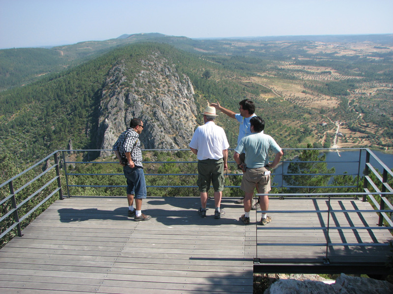
Miradouro do Cabeço da Achada Vila Velha de Ródão
This is a viewpoint of high scenic value, with a privileged landscape setting that provides one of the best panoramic views over Portas de Ródão Natural Monument and also over the Tejo valley and its stepped river terraces. From this viewpoint, you can see the meanders of the Açafal stream and the structure of the Alfrívida Dead Valley. As added values, this geosite presents exuberant native vegetation, namely juniper communities and imposing cork oaks, as well as the remains of a battery type fortification (Bateria das Batarias), witness of the French invasions and of the defensive line established by the summits of Serra das Talhadas..
Miradouro do Vale Mourão Vila Velha de Ródão
This is a privileged observation point, covering the entire valley from Foz do Cobrão and the Albarda fold to Portas de Almourão. The site has many additional values such as the olive trees cultivated on terraces built on the steep quartzite slopes, the village of Foz do Cobrão, the protected nesting rupicolous birds such as the black stork, the griffon vulture or Bonelli's eagle.
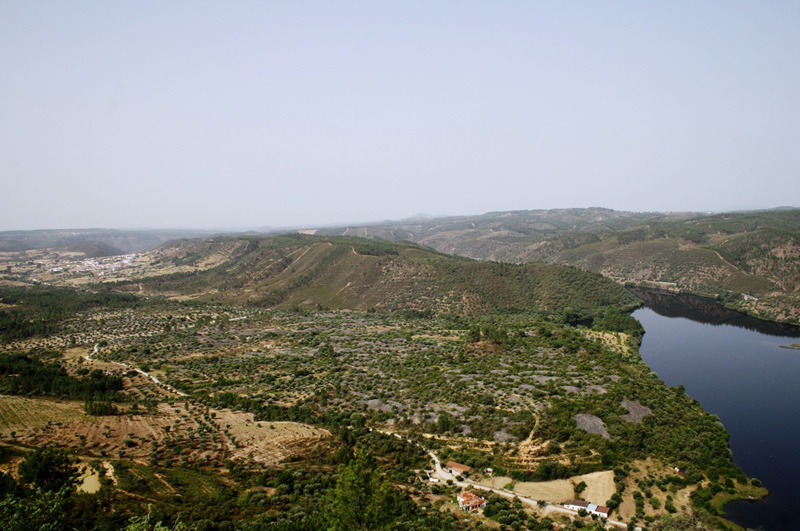
Miradouro do Penouco de S. Miguel Nisa
This viewpoint is located near the highest point of the municipality of Nisa, the geodesic vertex of S. Miguel, which registers an altitude of 461 m. From here you can see the contact between the schist landscape deeply carved by the Nisa stream and its tributaries and the well-preserved flattened surface of the Alto Alentejo.
Miradouro das Portas de Ródão Nisa
The Portas de Ródão Viewpoint is a strategic point to observe the Roman mining operation of Conhal do Arneiro. It provides a panoramic view of an area of about 600.000 m2 of the mining area, allowing some of the main elements that characterize this mining operation to be seen, such as the alignments of blocks on the banks of the channels, the Castelejo and the decantation lakes. This place has an important ecological value, with an expressive juniper and an important colony of griffon vultures nesting in the scarps of the quartzite crest, just below.

Landscape Museum

www.roteirodeminas.pt
Guide of the Portuguese Geological and Mines Sites.

Center of Portugal Tourism
Discover the best places to visit in the Center of Portugal.

Projeto ESTEAM
Meet the "Projeto ESTEAM - Enhancement of School Teaching Methods".
Geopark Naturtejo © 2025 All rights reserved
Créditos Fotográficos:
Pedro Martins
Stock Images of the Geopark Naturtejo
Developed by citricweb.pt